Sunday, August 15, 2021

Time Portal (or how I traveled almost 60 years back in time)


You might know the feeling. Maybe it’s a big pile of leaves in the fall and you catch that earthy scent as you walk by. You remember jumping in the leaves as a kid, throwing them up in the air, or raking them in the yard on a Saturday afternoon. Maybe it’s the smell of cookies coming out of the oven, the first snowfall of the winter, or a cold ice cream cone on a hot summer day. So many sights and smells and feelings that remind us of childhood and memories of growing up. But that’s not the feeling I’m talking about.

What I’m talking about is an actual time portal that I miraculously popped through while riding a bike on a narrow road on a small island in the Bahamas where, for a moment, I traveled almost sixty years into the past. I will try to explain it as best I can.

We’ve been coming to the same island in the Bahamas for fishing, diving, and tropical relaxation for around 20 years. We know the road that runs by our rental house as well as I knew the little road where I grew up on the Chesapeake Bay, where it was as hot and humid in the summer as any day in the southeast Bahamas.

First, I have to go back to my childhood memories, those moments that define my younger days, because if you want to understand how I went through what I’m going to call a time portal, you have to learn about some of the things I experienced as a child.

I often say the best years of my life were when I was 8 or 9 years old. I was old enough to be somewhat independent, but young enough to still be an innocent kid. My family was big and noisy: five children born between 1951 and 1956. Our neighborhood consisted of a partly paved road that during the 1950’s was a designated postal rural route – our mailing address was Route 3, Box 292. Three families lived on our road with eleven kids total, and our family held the majority. We came together and blew apart in the summer, joining forces to swim in the tidal river that fed into the Chesapeake Bay, splitting into groups of older/younger, boys/girls, army units, baseball teams, make-believe players, explorers, and more. We burst out of the house in the mornings, finishing our chores and looking for adventure. Our mother would supervise us when we swam in the river, but mostly we ran wild and played in the woods and along the shoreline of our neighborhood.

Things quieted down in the afternoons, which were often too hot for boisterous play. But the action picked up again after dinner in the summer evening, when a little bit of shade and a breeze from the river gave us the energy to run wild again. This was a good opportunity to jump on our bikes and race up and down our road, crazy and sweaty as we yelled at each other and made up races and games. The envy of the neighborhood was Ricky Larrimore’s 3-speed English racer bicycle, with a beautiful dark green frame, mysterious levers, drop handlebars, hard leather saddle and weird looking pedals. We all took turns riding it, and I remember that although the frame was much too large for me, it felt wonderfully light and balanced. We were all skinny arms and legs with scabby knees and bug bites and bare feet. More than once I ripped my big toe open when my foot slipped on my pedal and scraped along the rough pavement at high speed. There would be an excruciating moment of agony followed by gasping sobs as I’d wait for the worst of it to pass. Then when I realized I was being left behind I’d pedal furiously to catch up, traveling into the fading light. When our mother blew the whistle that signaled time to come inside, I’d limp into the house to wash my bloody toe in the little bathroom by the kitchen door that was the designated dirty kid entrance, inspect it for signs of serious injury, cover it with a band aid and vow to be more careful next time. If you grow up in a big family, you learn self-first aid at a young age.

When I wasn’t ripping my toe open or arguing with the other kids about what game we were going to play or trying to show off a new skill I’d learned on my bike, I would have moments of complete clarity. Somehow in the back of my 8-year-old brain, I just knew that riding my bike along a quiet Maryland tidewater rural road in the middle of summer in the late evening air, was as good as anything in life could be. This usually occurred during those rare moments when I was alone, maybe the last one to come in to the house, or more likely just left behind by the older, faster kids.  

I would find myself alone at the far end of our road, pedaling up and over a small rise to where I could see the other kids. Suddenly and without warning, I floated free, moving effortlessly through the warm summer air, and experiencing a moment of pure bliss in the fading light. For a brief second, I would not have been surprised if I floated right up with the fireflies as they started to work their magic in the dark evening shadows of the trees. 

That is the feeling I am talking about.

As I topped the small rise in the road I started to hear and see the others and I came back to the present, but I always knew those blissful moments of floating free were something to be savored and could not last forever.

Then I grew up. Everything started to look smaller and one day my world wasn’t as wild and adventurous as I once thought. The moments of childish wonder and bliss began to disappear. I moved to Alaska and rediscovered some of that magic, watching alpenglow on high peaks while camped on an icefield in the middle of summer, or kayaking next to a pod of whales in the ocean. I’ve had many magical moments, but nothing like when I traveled through time and became eight years old again.

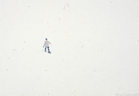
I dive with our friend Delbert every year when we visit the Bahamas. Bicycling to his house down the road from our rental house is a routine part of our island stay. My husband Scott and I check in with him to see when he might be available to take us out. Other times, we just stop for a short chat with him and his wife. Right before we leave the island, I visit one last time to settle our accounts with him and to say goodbye. On this afternoon, right before dinner, Scott stayed behind to take care of things at the house, and I went to Delbert’s on my own. We had a good visit, the bill was settled, good-byes were said, and I hopped back on my bike to pedal up the road. I felt relaxed, the evening air was warm and mild, and the biking was easy. I had absolutely nothing on my mind as I started to climb the first small rise that led back home.

And in that moment I traveled through time.

I gasped with wonder as I pedaled. I didn’t just feel like I was eight years old again, I knew I was! It felt so magical I could hardly breathe. I stared straight ahead, afraid to look around and possibly break the spell. I felt weightless and free and floated along the road exactly like those summer evenings in Maryland almost sixty years before. The air was warm and mild, and a gentle humid breeze swept along the tropical brush by the road. The salty tidewater close by smelled just like the Chesapeake Bay waters where I grew up. The most miraculous part, and the only proof I needed to convince myself I had traveled through time, was I felt so loose and childlike that not a single muscle or joint in my body ached or felt stressed in any way, as only an eight-year-old can feel.

The sensation faded as I crested the rise on the hill. I stopped for a minute and thought about what just happened. I was myself again, all sixty-plus years of me. I shook my head in amazement and looked behind me, half expecting to see a swirling portal in the road. Part of me wanted to go back and stay there, to escape the feeling of growing old and achy and creeping towards the inevitable. I knew it was impossible.

I sighed, but I was not sad. I was grateful for that moment of clarity and thought of it as a gift. I certainly felt peaceful and light. I’ve tried to go back and recapture the feeling several times since then and maybe one day I will. I want to think that’s how I will feel when I finally cross over from this life to the next, and that’s a lovely thought. An experienced yogi who can meditate deeply may be familiar with the feeling. Meanwhile, I will keep moving forward, remembering to keep doing the things I enjoy and that keep me young, even as I grow older.

Friday, August 3, 2018

Juneau Ridge - It's Just Walking


Let’s skip right over the fact that I haven’t written a new blog post for almost three years and talk about what matters right now – I am writing a new blog post with no excuses for a long absence. I’ve been busy, o.k.?

I am still hiking and skiing and biking and kayaking and taking photos and continuing to do all of the outdoor activities that I’ve done for the past 45+ years in Juneau. None of that has changed. I just haven’t taken the time to write about it, despite requests from friends and strangers. Yesterday at the far end of the Juneau ridge I encountered a very pleasant hiker named David who said he’d read and enjoyed several of the pieces I’ve written. For some reason that tipped me over the edge – figuratively, not literally! – and here I am.

I’ve written about hiking the Juneau ridge in late spring when there was still quite a bit of snow above tree line. That is truly one of the best ways to enjoy that hike. Glissading down the snow into Granite Creek basin is not only the next best thing to skiing, it cuts a large chunk of time off of the otherwise long descent off of the mountain.

Yesterday’s hike was 100% snow free due to our unusually warm dry weather of the past few weeks. For a Juneau hiker who thrives in the cool misty rain, the hot sunny weather has been a bit of a challenge for me. With that in mind, I got an early start, parking the car at the Perseverance trailhead a little after 8 a.m. (Hey, come on, I’m retired. I don’t really do 5 or 6 a.m. starts.) This still gave me plenty of time to climb up before it became too hot or buggy. I had to do a quick backtrack after the first five minutes when I remembered that I hadn’t locked the car – yikes! – but that meant running into an old friend who was jogging on Basin Road and who graciously walked with me for about a half mile, helping me get started on my solo hike with pleasant conversation and memories of days gone by when we were both young and could hike forever without getting tired.

Honestly, the most challenging part of hiking the Juneau ridge is not the ridge itself – it’s grinding your way up the (expletive deleted) Mt. Juneau trail. Despite all the many wonderful improvements that trail workers have made over the years, it’s still a steady, steep elevation gain, rising to over 3,500’ in just a few short miles. Whether you are hiking the ridge or not, it’s always a good idea to get started before the sun beats down too strongly on the mountainside. Even with a morning start, by the time you get above tree line and start to encounter a little bit of a breeze, you feel like you’ve been sweating in a steam bath.

The hike up was pretty straightforward, not too many people on the way other than two different groups of people I knew who were also planning to do the ridge and a pair of strong young men pushing mountain bikes up who planned on riding the ridge. The worst part was over and done before I knew it.

Right before I reached the summit, a helicopter deposited a small group of hikers on the top of the ridge. I’m not sure I’d be willing to pay hundreds of dollars – or whatever it costs – to save myself a couple hours or less of hiking. I consider the climb to the summit to be a warm-up to the ridge and somehow it wouldn’t feel the same if I was suddenly whisked up there. At least that’s what I tell myself. I was proud of my dirty, sweaty legs and stinky clothes as I smiled and hiked past them. I was going to take a quick break at the top but decided to put it off until I got far enough along so that I felt more committed to the ridge. So far, my legs felt good and it was such a relief to get off of the trail to the summit that I thought I could push on without stopping.

As I went along the first little bump in the ridge, I reached into my pack for some quick energy in the form of the perfect trail food – half of a Snickers bar. After the first bump, it was a classic case of “Well, I’ve made it this far without stopping, I may as well go a little further.” The weird thing about the Juneau ridge is the so-called summit of Mt. Juneau is one of the lower points on the ridge. It continues to meander through rocks and alpine meadows that climb up until you reach a high point of over 3,800’ at the far end above Granite Creek basin. What made it seem so easy was the perfect conditions – dry firm trail, light breeze, incredible views and not another hiker in sight. I know the ridge so well that I was completely relaxed as I hiked, hardly thinking about where I was going to go next or wondering about what lay ahead.

I covered up from the sun before I started along the length of the ridge. I wear a super lightweight, long-sleeve shirt and a baseball cap and reapply sunscreen on my face and legs so I don’t get burned or sick from the sun. The very first time I hiked the Juneau ridge back in the 70’s it was another brilliantly hot sunny day and I was young and stupid. The fancy sunscreens we have now were not yet invented. We actually used zinc oxide on our lips and noses when we felt the need to protect our skin on the glacier or the icefield, but didn’t think much about it when just hiking the local trails. I spent that long-ago day in a tank top, shorts, and no hat and I drank very little water. Carrying drinking water seemed silly because we were surrounded by small creeks and streams on the mountainside. We took regular skinny dip breaks in every pond along the way, and that certainly didn’t help with protecting my skin! By the end of the day I was severely sunburned and alternately shaking with the chills and sweating with fever when I got home. Lucky for me that my housemate was a nurse who recognized the signs of sun poisoning and gave me the care I needed.

Over forty years later I am much older and hopefully wiser. I stayed covered up above tree line and drank water all day long from the hydration system in my small pack. The Snickers bar kept me going all the way to the end of the ridge. I kept looking to see if I could spot any of the hikers I knew were following behind me, but there was no one. For the first time in several years I didn’t encounter hikers or runners coming from the Granite Creek side either, so I enjoyed a quiet lovely hour or so walking along the ridge.

Right about the time I decided to truly stop and take a real break before dropping into Granite Creek, I was startled to see a fit looking hiker with a dog appear close behind me! We shared some pleasant conversation and, as I mentioned at the start, he gave me the nudge I needed to write again. Thanks, David! I watched him as he continued his own hike, and although he didn’t seem to be walking at a particularly fast pace, he soon disappeared from sight. I think he may have been a stealth runner.
I took my time dropping down into Granite Creek basin, reluctant as always to leave the high alpine country behind. It is so magical up on the ridge with views of giant granite icefield peaks as far away as Canada and colorful tiny mountain flowers at your feet. At this time of year, the patches of snow had completely melted and sparkling pools of bright blue water dotted the ridge. Looking down on the trail winding into Granite Creek always reminds me of scenes from The Lord of the Rings, and it wouldn’t surprise me at all to spot Legolas running swiftly across the mountain heather. Sometimes in the middle of winter I even dream about this one particular stretch of trail, that special place between the high country and the lowlands where it seems like something magical can happen.
Something magical did happen as I entered the lush green upper basin and found fields of pink magenta River Beauty (also known as Dwarf Fireweed) stretching across the landscape. I knew that I was on track for a fast hiking pace, but I managed to stop several times and try to photograph a scene that would soon disappear with the stretch of cooler weather and cold rain that was forecast for that
night.
I began to encounter hikers coming up from the Granite Creek side, and it was especially nice because I knew just about everyone that I saw. The Juneau ridge is a great solo hike, because you are really never alone. I probably saw and talked to as many friends as I would see at a small social gathering! Another wonderful aspect of coming out from Granite Creek was the significant trail improvements along the way. Trails crews have put down gravel and boards in the muddy spots and brushed and widened much of the route, making it much easier to get out to Perseverance Trail for the final two miles to the end.

Although my trail running days are mostly behind me, I can still manage an easy 10-minute mile jog downhill. As one of the elite mountain runners in town once said, “The faster you go, the faster you’re done!” So, when I hit Perseverance Trail, I switched into a slightly faster gear. I had to briefly stop and wash my muddy legs. I also needed to clean the patch of skin that brushed against Cow Parsnip, which can result in a nasty rash if you don’t rinse the area in cold water within twenty minutes.

Despite all the delays taking photos and washing up, and without the added speed of glissading down the now-melted snow gullies off the end of the ridge, I still made it back to the car in about 6 hours flat, a new personal record! I’m happy that my fitness level is holding steady without maintaining anything like a real training plan. One friend that I saw as I hiked out of Granite Creek said to me “Wow, you did the ridge! That’s amazing!” I replied “Thanks, but you know, it’s just walking!”

If you know how to walk, bring plenty of water, carry the right snacks and dress properly for the weather, the Juneau ridge is a great place to do your first ridge hike on a sunny day. The route is straightforward in good weather, with a well-worn path that is fairly easy to follow. Just stay on the ridge to the end until you see a definite trail that starts to traverse along the side and follow it down into Granite Creek basin. Once you are in the basin, just keep to the small trail that leads out and before you know it, you are back in the land of day hikers, joggers and mountain bikers on Perseverance trail. Maybe I will see you out there!

Monday, November 9, 2015

Lost

I am not lost, just a little unsure of my exact location.

“Not all those who wander are lost”
J. R. R. Tolkien, The Lord of the Rings

What is lost? The dictionary defines the state of being lost as “having gone astray or missed the way; bewildered as to place, direction, etc.”

I have certainly gone astray. I have even missed the way and been a bit bewildered as to place, direction, etc. But I’ve never been lost.

I was on an outer coast kayak trip once with a friend. We paddled from Sitka to Pelican, often camping on the small barrier islands between the coast of Chichagof Island and the open ocean. One evening we had some time to kill before dinner. My friend chose to stay in camp while I decided to take a walk. I started along the shore for a while, then thought I’d save some time and cut across what appeared to be a very small piece of forest to the other side and cut back to camp. Meanwhile, I’d tell my friend that I’d walked all the way around the island. Big mistake. It soon became obvious the island was bigger than I first thought, and I quickly became disoriented in the woods. I managed to beat my way back to the shore, but by then I wasn’t at all sure where I was situated in relation to our camp. So I started walking. My theory was that I was definitely on an island, and if I just started walking in one direction, sooner or later I would stumble into camp. When I arrived hours after my friend expected me to show up for dinner, he accused me of getting lost. No, I said, I wasn’t lost. I was just a little unsure of my exact location. But the entire time I felt certain I was going to get back to camp. It was just going to take me a little longer than I first thought. And then and there, I developed my whole philosophy about being lost.

When I’m a bit unsure of my exact location, other people might want to be quick to say “I am lost!” I guess the difference is I’ve never doubted that I could find my way back, and don’t panic if I realize it’s going to take me longer than I originally planned.

In the early 1980’s, I skied across the Juneau icefield with three friends, traveling from Atlin to Juneau. We successfully navigated through whiteouts and crevasse fields, confidently using map and compass each step of the way and reaching Camp 17 at the foot of Cairn Peak right on schedule. The next day all we had to do was hike out Blackerby ridge, and we’d be home. In those days we didn’t have the well-worn foot path along the ridge and down through the steep forest that exists today, thanks to the hordes of ultra-runners and hikers who regularly travel there now. And it was a little cloudy and foggy on the ridge. And we were anxious to get home. We made it partway down the ridge when our group of four slowly split apart and became two groups of two, with my girlfriend and me in the back. We got a little lazy and decided to take a short cut along the ridge, which we figured would take us to the forest route the same as if we stayed right on the ridge to reach it. Big mistake. We were deep into the impossibly steep woods before we realized we were not going to find the trail and that we were going to have to somehow beat our way down to Salmon Creek without falling off a cliff or becoming hopelessly entangled in devil’s club and thick alder. Tears were shed, packs taken off and pushed through the dense brush, curses spoken. But never at any time did we sit down and say “We are lost!” We made it down to Salmon Creek in one piece, although we did lose an ice axe somewhere in the scramble. We crossed the creek, climbed up the slope on the other side, and fifteen minutes later we were on Egan Drive, just a couple of hours behind the other half of our group.

Really? Never lost? Hey, I made it home o.k. and no one had to come and help me, so my answer is no, I have never been lost. Pretty embarrassed, very scratched up and tired, but not lost.

The list goes on, I’m sorry to say.

My first summer in Juneau, I hiked up Mt. Troy with my boyfriend and we decided to take a shortcut down from the summit. That was my first real introduction to impossibly steep brush and devil’s club. The devil’s club on that epic misadventure was so thick and the slope was so steep that we ended up climbing hand over hand down a rocky creek running with icy cold water. That was a great incentive to learn to study topographic maps much more carefully and pay attention to those little contour lines when they tended to crowd closely together.

One winter afternoon I found myself skiing around Spaulding Meadows in circles for hours during a total whiteout, desperately trying to locate the trail out before dark. There were three of us, and we took turns convincing the other two that we knew where we were going, until it became obvious that we didn’t. A map and compass would have helped only minimally in this situation since we hadn’t taken any bearings when we first came up into the meadows and by the time the fog and clouds rolled in there was nothing to take a bearing on anyway. We were right on the brink of settling in for the night by digging a snow cave when I suddenly recognized a group of trees and somehow convinced the others that we were only a few hundred yards from the trail. It was pitch black by the time we were halfway out and none of us had a headlamp, but we made it home o.k. Even if we hadn’t, we would have survived the night camping in the snow – snow caves can be surprisingly cozy – and safely traveled out the next morning. We weren’t lost, just a bit disoriented as to our exact location, and we knew it was going to take us longer to get home than we originally planned.

From the sound it, you might assume that I was blindly going out and getting myself in trouble on a regular basis. At times that was true, but it wasn’t because I was ignorant. I spent a great deal of time learning to use a map and compass properly, practicing on easy hikes where the trail was obvious. I learned about true north and magnetic north and memorized the declination for the Juneau area. I took sightings and figured my exact location on a map by drawing a triangle from two known points using my compass and checking the angle from my line of sight. My mistakes happened when I got careless and wasn’t paying close attention because I thought I was on known or easy terrain, or because I was tired and looking for a quick shortcut.

Now we have a wealth of GPS devices and, dear lord, we have cell phones. I carry a cell phone whenever I go out, and I have a very cool GPS app on it that I will refer to when I’m a little confused as to my exact location. But I think the most important piece of equipment that I carry with me is my brain. I watch the trail or terrain I’m travelling much more carefully than I did when I was young and reckless. I look ahead to where I’m going and I look behind to where I’ve been, noting landmarks around me that I might need to refer to again on the return trip. I still carry a map and compass, because as cool as my GPS app on my phone is, it still needs a battery and batteries have been known to fail.


As I was putting the finishing touches on this story, I ran into a group of hikers from the UAS outdoor studies program hiking down the Montana Creek road. I had mountain biked up the road and was on my way back down when I ran into them. I hadn’t seen them on the way up so I wondered where they had come from. One of them told me they had hiked down through the steep woods from Spaulding Meadows using only map and compass, deliberately navigating through unmarked terrain. I was impressed. That is some tough terrain, brushy and steep, just the kind of terrain where you could get lost. They not only found their way down to the Montana Creek road successfully, they still had a bounce in their step, were in good spirits, and still had many hours before dark. Here was a group of a dozen college age adventurers who were learning solid navigation skills. They will probably never have to call for help because they thought they were lost, although they might be a little unsure of their exact location and might get home a bit later than they originally planned at times. That’s just part of the adventure.
Late for dinner again

Wednesday, September 23, 2015

What About West Peak?

If you love being outdoors in Juneau, then you are familiar with most of the local mountains that are popular day hikes. There’s Mt. Juneau, obviously, then Gastineau Peak, Mt. Roberts, and Sheep Mt. Looking at Douglas Island from downtown Juneau, Mt. Bradley (aka Mt. Jumbo) dominates the skyline, and Mt. Troy welcomes hikers traveling up the Dan Moller trail or crossing over from Eaglecrest. In the Mendenhall Valley no one can ignore Thunder Mt. and Mt. McGinnis. Even Blackerby Ridge and Cairn Peak are now hiked so often a trench like path has formed in places along the ridge. These are the peaks that are hiked frequently and often have several groups at a time on their summits on a nice day.

Alone on the summit of West Peak. We had the mountain to ourselves all day.
But what about West Peak? If you stand on Gastineau Peak or Mt. Roberts and look directly southeast, you will first notice Hawthorne Peak, standing tall at 4,210’. Immediately to the right are two smaller mountains – Middle Peak and West Peak. They are all beautiful mountains, but getting up them requires a bit more thinking than say trudging up Mt. Juneau. It makes sense to climb up Hawthorne from the Powerline Ridge above Sheep Creek, first following the Sheep Creek trail to the alpine and then working your way over to the Hawthorne summit ridge. But no formal trail exists to access either West or Middle Peak, which are connected to Hawthorne by a very sketchy steep ridge and should only be attempted by experienced mountaineers.

I have a long ago memory of hiking West Peak with some friends in late September 1974. We picked that time of year so the brush would not be so thick, because we intended to bushwhack up from Thane Road until we got above tree line. And, oh what a bushwhack it was, too. We pushed straight up through devil’s club, old berry bushes, nettles, tangled alder, and thickets of nameless weeds, following the contours of a USGS map and using our compasses to keep us on course. I remember looking up the slope through the forest at one point and seeing a gray wolf standing perfectly still. I blinked my eyes and he disappeared.

When we reached the alpine zone, we enjoyed a pleasant stroll across benches of heather turned red and gold in the cool fall air. The sun was shining, but we kept our layers on, as the higher we climbed the colder it got. There were no tracks or paths to indicate that anyone came up this way on a regular basis, but that was not too unusual back in the early 1970’s when the population of Juneau was barely half of what it is now.
Fall is the best time to hike up West Peak
I returned to West Peak five years later in late October 1979. We followed the same rough route to the alpine, and were greeted on the summit of West and Middle Peaks with a small snowstorm and chill winds. This was a “hiking date” with Scott, who had just moved to Juneau the year before. I think this was the hike we did where he found out that yes, I really did like to be outdoors in the mountains, no matter what the weather.

Fast forward 36 years to September 2015. Scott and I woke to a sunny day and wanted to go for a hike, but hadn’t settled on a specific place yet. We spread the map out on the breakfast table and studied it for a few minutes. Then Scott said, “What about West Peak?” A friend had recently pointed out an unofficial and relatively unmaintained trail that roughly led to the West Peak alpine area, so we decided to give it a shot. I figured anything had to be better than blindly crawling straight up through dense brush.
We enjoyed a much nicer climb up to the alpine than we did 36 years ago.
We climbed up through the forest from Thane Road, just past Sheep Creek, and followed a small winding trail to tree line, then an even smaller track through the brush. We had to stoop to get through some of the heavier brush, but there was always a faint trail occasionally marked with tiny bits of orange tape to show us we were on the right path. We continued our steady climb up through rocky, muddy sections, and I let out a mild curse when my foot was sucked into a mud hole at one point. It was not a big deal, because the sunny skies guaranteed my shoe and sock would be dry within the hour.
A clear, cool, breezy fall day - perfect!
We popped out of a brushy gully and reached the open alpine benches, which looked familiar even after all these years. I glanced down the steep hillside further on, where I had climbed up so many years before, and I shuddered. Only an energetic twenty-something would be crazy enough to do that more than once! I was grateful for the marked route we followed this far, rough as it was.

Once we were above the brush, it was up to us to find the best route to the summit of West Peak as there are still no clearly defined paths to follow. We worked our way across the ascending benches, trying to locate the most efficient way up without getting back into the occasional brushy zone and without losing extra altitude whenever possible. We wandered up separately, coming together in spots only to break apart again as we climbed up. It’s so fun to be able to wander freely on high alpine meadows, away from the constriction of dense trees and brush! The day was brilliant, although the breeze picked up and blew so strongly it almost snatched my cap off of my head. We each put on an extra layer and tightened up zippers and hoods.
Wandering through the alpine zone

You go your way, and I'll go my way
As we climbed together up a small ravine that led towards the final summit approach, something caught my eye along the ridge above us. It was large, dark, and – holy smokes! – a bear!!! Neither of us had an adequate camera that day because we wanted to travel light, so we missed grabbing a shot of him. That didn’t keep us from enjoying watching him come down from the summit, until we realized he had no idea we were right in his path. I decided to yell so he would at least be aware of our presence. He stopped and whirled around this way and that, trying to catch our scent and figure out where we were. Bears have terrible eyesight and we were too far away for him to see us properly, so I yelled again. This time he was sure of our position and he ran off to the side as fast as he could go, which was impressively fast. A good reminder that there is no way a human could ever outrun a bear.
All routes lead to the final summit slope
Stepping carefully on the steep hillside
The final hike to the summit was steep but manageable, and to our delight the summit was just out of the wind, so we could stretch out to eat our lunch and relax in comfort, snapping photos with our tiny compact cameras. We didn’t take the extra time to go over to Middle Peak, but it looked very tempting. Next time, for sure. Only we will not wait another 36 years, now that we are reminded that West Peak is just another day hike.
Middle Peak from the summit of West Peak
We never really needed our friend’s route finding instructions until we began our descent. There are many gullies that drop into the brush below and it’s important to find the right one to start down, unless we wanted to repeat history and thrash our way to Thane Road the old way. A few checks of the GPS route kept us on course, and we quickly recognized the right spot to start down with only a few small corrections. I generally don’t like depending on GPS tracks, since I learned map and compass work the old school way, but it does come in handy now and then. Still, it’s good to have strong skills navigating using a system that doesn’t rely on battery power.

Which way do we head down?
What about West Peak? Done and done. Now we have to go back and complete the hike by adding on the Middle Peak summit. As I repeat adventures in my retirement years that I once did as a young hiker newly arrived in Juneau, I am thrilled to find them much as I remember. I hope they stay that way for the generations of outdoor adventurers that follow.


West Peak; 3,620 ft., 3 mi. ESE of Thane and 7 mi. SE of Juneau, Coast Mts. Local name reported in 1917 by D. C. Witherspoon, USGS. Dictionary of Alaska Place Names, 1971, p. 1038.
Mt. Gastineau - Mt. Roberts - Sheep Mt as seen from West Peak


Monday, September 7, 2015

Thunder Mountain traverse - now and then

Yes, I'm still hiking!
Yes, I have been hiking. No, I have not been writing about my hikes. I have been approached by quite a few people over the past 11 months (has it been that long since my last blog?), asking me when I was going to write again. People have talked to me in the grocery store, at yoga practice, on the ski trails in the winter and the hiking trails in the summer. Last night at a classical music concert, someone tapped me on the shoulder and asked me yet again. Tomorrow, I answered. I’m going to write a blog tomorrow.

Let me start by telling you about my first big hike early this spring. Scott and I did smaller hikes all through the winter due to the depressingly low snow cover. We also skied over 55 days, thanks to helping to coach the Juneau Nordic Ski Team, which somehow located enough snow to train on from December through March. So we stayed in decent shape for the beginning of the spring hiking season, and felt confident enough to start off with a point to point mountain traverse – up Thunder Mt and out East Glacier trail – with which we were not entirely familiar.

The Thunder Mt trail starting behind Glacier Valley School is in great shape
We started on the Thunder Mountain trail at the end of Jennifer Drive, behind Glacier Valley School. I have mostly climbed up Thunder Mountain starting from the other side at mile 7 Glacier Hwy, north of the DOT building, and I was pleased to find the Jennifer Drive trail much easier and less confusing to follow, even as it began to climb steeply uphill. I have come down the trail on the Jennifer Drive side once, back in the early 1970’s, and I’ll get to that story later, but I will remark that the trail was not so easy to follow then.

The day was warm and sunny, and we enjoyed climbing up through the trees, following a well beaten route marked with occasional trail flagging. I kept expecting to encounter muddy sections – the Glacier Hwy trail crosses some extremely boggy sections – but overall this trail was much drier. It proved to be a popular route on a Saturday morning and we ran into hikers heading up and down the trail, admiring those who were up early enough to already be finishing their hike by mid-morning.

The two Thunder Mt trails come together high in the woods a short way below treeline
Right below tree line we met a larger group of hikers that we knew and we discovered they also planned to hike over Thunder Mountain and out to East Glacier trail. Not only that, but they were very familiar with the route, whereas Scott and I only had a general idea. We gladly joined up with them, and by lunch time we were sitting on the summit of Thunder Mountain, admiring the views of the Mendenhall Glacier and surrounding area. There really is nothing like seeing the glacier from Thunder Mountain, especially on a crystal clear spring day with snow on the summit. It’s a classic view, made all the more wonderful by good company and the prospect of a pleasant hike out a new route for us (or at least a route I hadn’t been on in over 40 years) without worrying about getting lost.


Flashback to the summer of 1973, my first full year in Juneau. My boyfriend and I decided to hike up to Heintzleman Ridge from the East Glacier trail, over Thunder Mountain and down to the Mendenhall Valley. We had a map, a compass and plenty of youthful energy (no smartphones or GPS devices back then). My boyfriend had a fair amount of mountain climbing experience, so he led the way as we plunged through the devil’s club, alder, blueberry bushes, and mosquitoes, working our way up to the Thunder Mountain bowl. (Note: this route is best done in spring or fall, when the brush is not so thick.)  From there we climbed up to Heinztleman Ridge, which is a lovely mountain ridge on one end, but soon turns into a terrifyingly steep, narrow ridge as you work your way across. This was the first of many wilderness trips where I became deeply religious, promising all sorts of miraculous conversions of the soul if God would only save me “just this one time, please”. I received helpful instruction from my boyfriend along the lines of “don’t fall here or you’ll die”, and somehow we made it to the other end of the ridge without mishap. My journal entry for that day casually reads: hiked up Thunder Mt – peak 3610’ – down Heintzleman Ridge. Somehow that doesn’t convey the sheer terror I felt staring straight down into the Lemon Creek valley on one side and the Thunder Mt bowl on the other with about a one foot wide crumbling rock ridge under my feet. By the time we were picking our way down through the woods to the Mendenhall Valley, I really didn’t care if we were on a trail or not, so I have no memory of that part of the trip beyond stumbling downhill through very steep woods in the late evening. We did make it out in one piece and I do remember being tired, hungry, exhausted and probably dehydrated.

A side note on the energy of a 20 year old: After such a brushy, steep, terrifying, and exhausting adventure, it seemed like the natural thing to do the next day was to hike up West Glacier trail, camp overnight on the glacier, and then climb Stroller White. That was also a steep, exposed route but by then my mind was numb to discomfort and fear. The only note I made from that outing was: camped at second icefall, climbed Stroller White, Pooch hit by rock (Pooch was our small brindle bull terrier, an energetic and fearless climber with more experience than I had).
It helps to have friends who know the way
Back to the present: You can imagine how lighthearted I felt as I hiked safely and confidently with an experienced group of friends up and over Thunder Mt, avoiding Heintzleman Ridge, happily glissading down the smooth snow slopes into the Thunder Mt bowl. From there we followed the route leading out to East Glacier trail, marked by trail flagging in a few places and reinforced by a friend’s GPS track that she consulted at a few key spots. The thing to keep in mind on this route is to not drop down too soon, but to keep in the open high meadows, bearing right and looking for any signs of flagging before locating the trail leading out through the woods. Once you’ve located that small trail, it’s a pretty straightforward hike down. At one point the trail follows old pipes that brought water to the Nugget Creek power plant workers. You finally come out on to the East Glacier trail, a short distance below the series of steep wood steps on the trail.

Things you can see in the lovely meadows that lead out of the bowl depends on the season, but you can look for wolf and bear tracks, wildflowers, berries, ptarmigan, eagles, hawks, stands of yellow cedar, and the every changing colors of the alpine meadow grasses and plants. You’ll want to linger and enjoy these meadows almost as much as the views from the top of Thunder Mt.


By mid-afternoon we were finished with our mountain traverse, and I am happy to report that I felt extremely happy, well-fed, sufficiently hydrated, and only mildly tired. While I did not camp on the glacier the next day and climb Stroller White, I have continued to hike throughout the summer. I look forward to sharing some of those adventures with you over the next few weeks and months as I try to get back into the swing of writing my blog.
A happy group after a successful traverse
Thunder Mountain, 2,900' elev. Thunder Mountain traverse from Jennifer Dr trailhead to East Glacier trail is approximately 8.5 miles, 3,100' total elevation gain.Thunder Mountain is a local name reported by USGS in 1965.


Wednesday, October 8, 2014

My PFD Came One Day Early On Blackerby Ridge


Every time I looked at the weather forecast, I had to rub my eyes. The rain followed by showers followed by more rain was easy to believe. But what was this sunny weather predicted in the middle of the week? At one point the forecaster was bold enough to call for “abundant sunshine”, which remains one of my favorite weather descriptions. Plans needed to be made.

Scott already committed to a nordic ski trail project for the day, so I had to go through my list of potential hiking partners. Some could not take time off work; others were out of town or had conflicting plans. I was on my own.
When I was working full-time I used to love to take every possible chance to go up in the mountains alone. I savored the peace and solitude away from the downtown crowds I dealt with on a daily basis in our retail shop. Since I’ve retired I’m not so anxious to be alone, but rather enjoy the opportunity to talk and socialize on the trail with friends. Still, if I was going to hike alone, at least I knew how to handle myself after many years of solo travel.

Wednesday, October 1 – we measure our sunny days in Juneau one by one this year, now officially the rainiest year on record. A thick early morning fog promised clear skies in just a few hours as I drove to the Blackerby Ridge trail head. I had no illusions about the condition of the trail before me, which is a steep, nasty climb through the woods under the best of circumstances. But with all the rain this summer and fall I knew it would be a muddy scramble most of the way to tree line. After that, I would probably be up to my ankles in fresh snow. The clear skies and unlimited views from the ridge would be my reward.

I am not as familiar with the Blackerby Ridge trail as I am with the Spaulding trail, which I’ve memorized turn by turn. But to help the time go by as I climbed up alone, I pretended that I really did know each section of the trail and could visualize what was ahead. I surprised myself that I actually was very familiar with many parts of the trail – the climb up next to the huge fallen tree, the steep dirt cliff with a fixed line, the fallen tree trunk with the step cut into it, where the trail went left and then right and then straight up again. Looks like I need to add this route to my bedtime visualization exercises.

Soon enough I was up to the first meadow that offers a breathtaking view of Mt. Juneau. This is the moment when all doubts about being alone are instantly erased. I wanted to pull my camera out and start taking photos, but I was too anxious to keep moving until I was right on the ridge. Up until now I had kept my good camera with the telephoto lens protected from the wet, muddy trail and didn’t want to take the time to dig it out quite yet. I would soon regret that decision.

As I climbed through the scattered brush and trees to the open ridge, a slight movement above caught my eye. I was astounded to see a large mountain goat lightly tripping down the hiking trail without a care in the world. He had no idea he was headed straight for me. I held my breath and slowly sank to my knees, silently cursing to myself for not having my camera out. I fumbled at my pack’s side pockets, never taking my eyes off of the goat who was now less than 50 feet away from me. I managed to grab my smartphone and slowly raised it to snap some photos. The goat spotted me and stopped still. Because I was kneeling, I don’t think he could figure out what I was. I kept very quiet and took as many pictures as I could, praying that one of them would turn out. Finally I put the phone down and just stared back at him. He was only 30 feet away and still checking me out, moving his head a little from side to side. I quietly said, “It’s o.k. I’m not going to do anything. I just want to go hiking on the ridge.” He started a little, and then seemed to catch my scent as he whirled and disappeared up the trail so fast I could barely keep my eyes on him.
My original goal was to hike on the ridge and take photos, maybe look for mountain goats and try to capture them with my telephoto lens. But within the first 90 minutes of my hike I’d already come closer to a goat than I ever had in my life and I wasn't even on the ridge yet. Lesson learned: always keep my camera at hand when I go outdoors, no matter what.

I probably wasn't going to see goats or any other wildlife on the ridge as I'd originally hoped, because it was covered in new snow and my footprints were the only prints evident for a long distance. Instead, I soaked in the views of the newly snow covered peaks. A falcon circled overhead and a group of ravens played in the wind thermals, shooting up and floating in random, playful patterns against the blue sky.

I knew right away that I would not try to go up Cairn Peak at the end of the ridge, although there was plenty of time. Since I was alone and not sure of the footing in the fresh snow on the steeper sections, I decided not to risk it. I later learned a small group of runners came over Observation and Cairn Peak from Granite Creek after I left the ridge and they said the footing was good, but I tend to be more cautious when hiking in the mountains without a partner.

I traveled to the last high point on the ridge before it drops over to Cairn Peak, stopping and looking around and trying to take it all in. The clear, brilliant sky was difficult to comprehend, my mind was so fogged by the endless succession of rainy days, but I did my best to enjoy it. Summer was most certainly over, and the chilly breeze along the ridge kept me bundled in layers I hadn’t had to wear since early last spring.

As I wandered the length of the ridge, I gazed at all the delights the unusually brilliant weather had to offer. The sky was so clear I could see Mt. Fairweather in Glacier Bay National Monument, rising over 15,000 feet high and about 100 miles distant. The peaks of the Juneau Icefield looked close enough to touch, and the new snow on the previously bare rock had a lacy, decorative look. Douglas Island and Admiralty Island were lush with green, red, and gold fall colors.
Mt. Fairweather - 15,325'
The ravens continued to fight for my attention, swirling so close overhead that I heard the rush of their wings as they approached me from behind. They perched boldly on the ridge in front of me, waiting until the last second to take off again and begin their acrobatics. I studied the falcons that occasionally appeared more closely. One was small and swift – perhaps a sharp shinned hawk? The larger one I positively identified as a peregrine falcon, although my camera was not quick enough to capture it.

I looked for a wind protected spot to eat some lunch, and settled behind a rock where hundreds of ground blueberries glistened in the midst of the cold, crunchy heather. They tasted slightly past their prime, a little sour, but not bad. When I first raised my hand to my mouth I started with fright – it was dripping with red and I thought maybe I’d cut myself on a sharp rock further down the ridge. Closer inspection revealed it was only blueberry juice, and I laughed out loud.

I leisurely picked my way back, stopping to take more photos and admiring the 360 degree view of mountains, blue sky, glaciers, and fresh snow; basically trying to put off the inevitable stumble down through the woods as long as possible. I kept hoping to see my friend the goat once more, but he stayed well hidden. One of the runners reported seeing him later that day when they descended, so he must not have wandered too far. I wondered what the odds were of having another close encounter like that again in my life.

Stumble, trip, half-fall, catch myself, keep moving down and try my best not to twist an ankle – that’s how I descend the lower part of the Blackerby Ridge trail. Going uphill taxes the lungs and leg strength, and going downhill challenges balance and coordination, so it’s a full mind/body workout. I played the trail memory game backwards, and once again was pleasantly surprised at how many little details I recalled, which helps the time go by so much faster on a rough descent.

Back at sea level, one could almost pretend it was a cool, late summer day as the sun continued to shine and runners jogged along Twin Lakes in shorts and t-shirts. Tomorrow would bring a sure sign of fall – the annual PFD (Permanent Fund Dividend) issued to all Alaska residents on October 2. I sighed with a happy tiredness, and smiled as I considered that I’d received my own PFD one day early this year: the priceless gift of a Perfect Fall Day in the mountains.

Friday, September 5, 2014

A Real Juneau Hiker


Ancient corduroy along an old section of the Windfall Lake - Montana Creek trail
Most of the low lying trails around Juneau involve hiking out and back. We are surrounded by saltwater on one side and the Juneau Icefield on the other, with glacier carved valleys hemmed in by high mountain ridges stacked up and down the coast. I remember my first year in Juneau, when I learned the geography of the ridges and valleys along the road system: Hawthorne Peaks-Sheep Creek-Mt. Roberts-Perseverance-Mt. Juneau-Salmon Creek-Blackerby Ridge-Lemon Creek-Heintzleman Ridge/Thunder Mt.-Mendenhall Valley-McGinnis. Up, down, up, down, up, down, up. If a hiker is willing to climb steep ridges and go over mountain peaks to connect to other ridges, then a hiking loop or point to point route is possible, but involves thousands of feet of elevation gain and loss.

There is one trail in Juneau that clearly stands out as a point to point route of a significant length yet never climbs more than 900’ above sea level - the Windfall Lake to Montana Creek trail. This trail crosses so much territory that a hiker needs to leave vehicles parked at two trailheads separated by almost 19 road miles. This can be a mind boggling logistical detail to the typical Juneau hiker used to parking at a trail head, going for a hike and then returning to the same trail head at the end of the day.

The first few miles of the Windfall Lake trail are very well maintained.
Neither Scott nor I had hiked the full through-route from Windfall Lake to Montana Creek, although both of us have logged many miles on each end and in the high country surrounding it. Every time I talked to someone who hiked or ran the full length of the trail I heard the same comments repeated: wet, muddy, brushy, poorly marked, slick boards, huge windfalls blocking the trail, bear sign everywhere. But how could I call myself a Juneau hiker without having at least hiked it once?

And how hard could it be? It is only 13 miles from the Windfall Lake trailhead at 26.7 mile Glacier Highway to the Montana Creek trailhead located at the upper Montana Creek bridge, 3 mile Montana Creek road. We have hiked plenty of mountain ridge routes that are at least that long, but also include anywhere from 5,000’ to 8,000’ of total elevation gain. Our confidence level was high and we were excited about seeing a little bit of new territory. Pretty amazing that after over 42 years of hiking, skiing, and climbing in the area we can still find new places to explore.
Somewhere between Windfall Lake cabin and the Montana Creek side, we enjoyed seeing territory that was new to us.
We picked the one day the weather forecast predicted it would not rain, which happened to be the day after Labor Day. We left a vehicle at the Montana Creek trailhead, and then drove out the road to begin our hike from the Windfall Lake end. We easily walked as far as the Windfall Lake cabin, admiring the fairly recent improvements to the trail – the well-built bridges and boardwalks over streams and swampy muskeg, and the wide, firmly packed path through the woods. No problem. As we continued past the far end of Windfall Lake, it was immediately apparent that most of the regular trail work ended at the cabin. The path was narrow and footing became tricky enough so that we had to constantly watch our feet so we wouldn’t stumble over the roots choking the trail or step into the mud holes, which appeared with increasing frequency. Still no problem – we are veterans of rugged trails such as Blackerby Ridge and Grandchild Peaks.

The windfall part of Windfall Lake became more and more apparent. The usual definition of windfall is “something good that is received unexpectedly”. Another definition is “something blown down by wind”. Suffice it to say the second definition is more appropriate here. Huge trees lay across the trail at regular intervals, and would have made it extremely difficult to climb over and around. Fortunately, some trail angels (most likely coordinated efforts from the USFS and Trail Mix) had chain sawed through the biggest trees, cutting a rough path. Once again, no problem.

Our steady hiking speed slowed just a bit as we crawled around the windfalls and watched our footing on the rough trail, but we were making good time. Then we began to encounter the dismal swamp portion of the trail. We were both wearing waterproof hiking shoes, and up to this point our feet were still dry. But how do you stay dry when the trail you’re trying to follow is underwater, with boggy mud lurking on all sides so that no matter where you step, the odds of dropping into a deep mud hole are high. You can play the odds up to a certain point, and heaven knows I’ve had plenty of experience trying to read wet trails to my advantage. But sooner or later there comes that sickening moment when your foot disappears with a soul wrenching, sucking sound and you’re almost up to your knee in black, sticky goo. Words are spoken. Your hiking partner wisely keeps quiet and continues moving ahead. You flail at the brush around you, trying to get a purchase on something, and narrowly miss grabbing a giant devil’s club bush. More words are spoken. You’re wet, you’re muddy, and as far as you can see ahead, which isn’t far because the brush is so thick, the trail doesn’t look any better. Ah, southeast Alaska.
You call this a trail?

"If you want to stay dry, you should stay home." (You can quote me on that.)
When you’re smack in the middle of an inescapable and extremely uncomfortable situation, sometimes you have glimpses of sublime beauty. Maybe it’s the contrast of things you are trying desperately to escape or avoid with things that make you gasp with wonder. As we punched our way through the dismal swamp, we saw lovely bushes of dark blue currants hanging over the trail. They were so thick and dark they looked like bunches of grapes. I’d like to say I will go back and pick them soon to make blue currant jelly, but the memory of the swampy trail and the continued wet September weather are keeping me close to home for the moment.
High bush cranberries in the dismal swamp

Tiny red mushrooms on the side of the trail by Montana Creek
Eventually we found our way through the dismal swamp and started to climb back up into a wooded area. This section of the route was the most fascinating. It was obvious to us we were following a route that was probably established over a hundred years ago by miners. I made a note to research more about the area when we got home, as I’m sure there are mining ruins to be found off the trail.

Past the dismal swamp and getting closer to the Montana Creek side - we are far back in the woods at this point.
More berries awaited us as we gained elevation and started to enter increasingly open country. We found ourselves over our heads in huge blueberry bushes with fruit that still tasted sweet and juicy on this early September day. I probably ate at least two full cups of berries just plucking them without breaking stride as I hiked by.

The clouds hung over the surrounding mountains most of the day
The trail opened into a small muskeg meadow and we took our first real break to eat a snack and look around. Clouds hung low over the mountains, but we started to catch a few glimpses of blue sky here and there. We pushed on until we finally connected to the Montana Creek side of the trail. We hiked this part of the trail when we crossed over from Spaulding meadows a few years back, so it looked very familiar. We’d given up all hope of keeping our feet dry, and happily splashed along in the wet bogs and through the mud until we reached the final section of the trail we knew would be dry to the end.

Back on familiar ground
When we reached our truck, I took a few minutes to wade into Montana Creek up to my knees, vigorously washing off as much mud as I could. Then I put sandals on my tired feet and sat contentedly as Scott drove us back out to get our other car.
Taking a quick break just a few miles from the end
We didn’t climb any peaks or ridges, but I felt as if I’d traveled through some wild and remote backcountry. We never saw another person from beginning to end. No cars were parked at either trailhead. There were not even the usual dog walkers on the Montana Creek gravel road. Maybe it was the long stretch of wet weather, maybe everyone was back at work, or recovering from the Labor Day weekend. All I know is that despite the unrepeatable things I said back in the dismal swamp, I love this trail. And now I can proudly call myself a real Juneau hiker.

“This route was once part of a trail system from Montana Creek to Echo Cove, officially established in 1907-1909 by the Territory of Alaska, to service Juneau Gold Belt mining sites. The strip of land with gold-bearing rock known as ‘Juneau Gold Belt’ ran from north of Berners Bay to South of Point Bishop. One of the mines . . . was up McGinnis Creek that is to the east at the end of the old Montana Creek Road. Other mining activity was carried on in the headwaters of Montana and Windfall creeks.” Mary Lou King, 90 Short Walks Around Juneau, Taku Conservation Society and Trail Mix, Inc., 2007, pg. 58.

To my readers - THANK YOU for reading my blog. I just reached 10,000 views! A small number in the huge world of blogging, but a big number for me.